Tuesday, September 25, 2018:
We were waiting on a package from American Diesel and it showed up at 1030, so we cranked up and moseyed over to the fuel dock for a pump-out. By 1150 we were in the Melvin Price Lock alone and we exited the lock at 1155. The lockmasters on the Mississippi locks are all about getting it done and they are helpful to the recreational boaters. We made certain to not miss turning into the Chain of Rocks Canal (at 1230) on the left descending bank right after the Missouri River junctions from the right. If you miss this canal, you hit the wicket dams or wing dikes and sink. Could be rapids too. I didn’t want to find out. It’s a fairly long canal leading to the Chain of Rocks Lock, but we didn’t have any commercial traffic to speak of and we entered the lock at 1320 and we were out again in ten minutes.
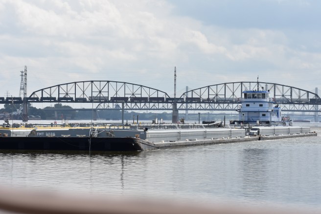
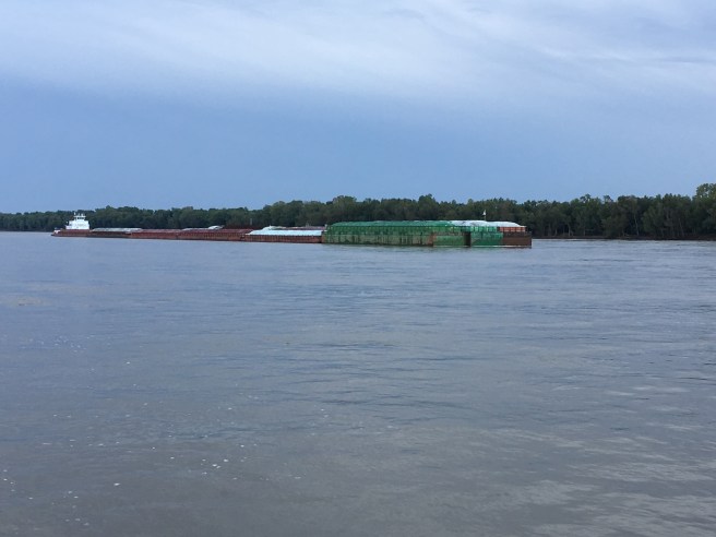
An up-bound barge with benzene passed us at 1342, we steered clear of him and negotiated the turbulence and the long wing dam at the fore-bay where the river rejoins.
We spotted Gumby II at anchor in front of the St. Louis Arch and got a picture for Scott and Christy.


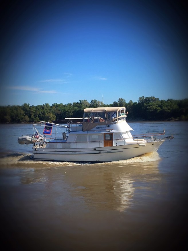
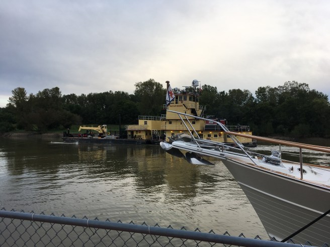
We passed on through St. Louis and at 1545 we slowed a bit to let the rain pass before trying to dock at Hoppie’s Marina. Hoppie’s really isn’t a marina in the traditional sense. It is just a couple of old rusty barges that they have for boaters to tie to.


One Looper said you best have an up-to-date tetanus booster to land there. Oh, and it is full current so you have to come about and edge over, keeping the bow pointed up river. The rain did pass somewhat and we docked with the help from Ray and his other brother Ray on the dock. They know what to do and what to tell the captains for a safe landing. The best part of being at Hoppie’s is the river briefing conducted each night for the transients. It used to be run by Fern (she owns the place), but she’s had a knee replaced so her daughter, Debra, has taken over the duties.

Debra did a yeoman’s job and we felt like we knew what to expect all the way to Paducah. My electric connection was not the right voltage/amperage to keep our air conditioner working, so I got with Ray and I used my splitter and plugged into the 50 amp circuit. It was fine after that. All in all it was a good day and we made 44.2 miles on the Mississippi, but the night was spent getting rocked by wakes from the passing tows.

Wednesday, September 26, 2018:
Ray and Jonathan (sail boater) helped us get off the dock at 0925. Directly, we were cruising at 13 ½ mph at 1800 rpm.
It was cooler in the morning at 59 degrees and a few clouds in the sky. We were traveling with Happy Destiny, Sauvy B, and Imagine. There was some debris in the river to dodge and at 1150 we noted that we’re in just over 70’ of water and getting pushed about by eddies. We turned up the Kaskaskia River and at 1255 we tied to the lock wall below the Kaskaskia River Lock. This is a good stop when going down the Mississippi and there were a number of Looper boats there with us: Float Her, Gypsy, Sauvy B, Aslan, Caeruleus, Tip-Sea II, Imagine, Happy Destiny, and Tortuga.
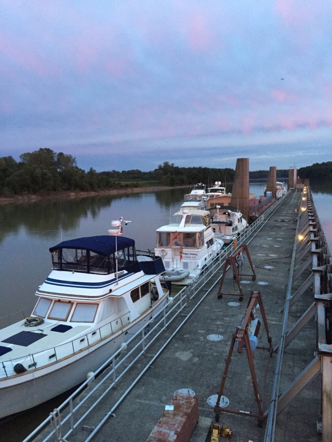
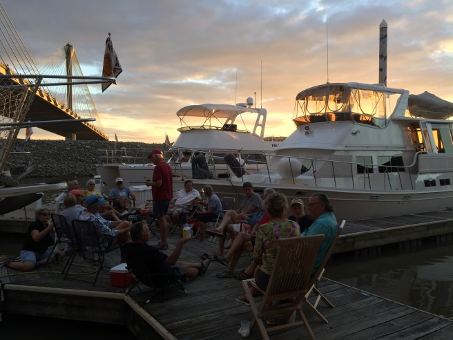
There was a Corps of Engineers barge tied at the wall and boaters were given permission by the lock master to tie to it since space on the wall ran out. Some boats were rafted to others. The COE barge looked like it was set up for some sort of recreational activity. There were chairs and an area that was covered. We decided that we should just commandeer it for docktails. (Sometimes better to ask for forgiveness than permission.)
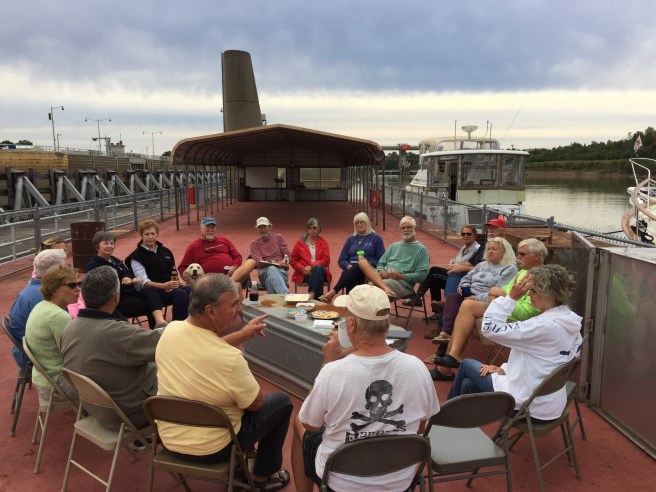
It was a good gathering and much was discussed about who was going where next. As we were breaking up the COE tug Pathfinder showed up and informed us that they were to take the barge at 0630 in the morning. We decided anyone parked near it best move early.
Thursday, September 27, 2018:
We woke up later than we wanted at 0635, cranked the engine at 0640 and were off the wall at 0646. Jane’s log entry for the weather says: “Who knows? It’s dark.” We reentered the Mississippi and continued on downriver. At 0745 I figured that we are about halfway done with our 220 miles of the Mississippi River. Then we will be turning upstream in the Ohio River. We made good time with the current and we passed a fair number of barges, some with large loads.
We continued to dodge the logs and debris. I noticed that the tachometer drops out from time to time. I’ll have to figure that out. During the run, we passed Cape Girardeau, Missouri. My ancestor, Joseph McFerron, was an early settler here and signed the city charter. He was also involved in the first duel between Missourians which took place on an island in the river. He won.


I have been in touch with an old friend, Jere Plumley, who has been coming down the Mississippi from Wisconsin. We are trying to figure where we might be able to meet up and now they are just a day behind us. It was a mostly cool day and we covered 110.6 miles before we anchored behind Boston Bar just upriver from the I-57 Bridge at mile marker 7.7. It was a quiet anchorage and we were the third and last boat to come in, but we had ample room and good holding in about 10 feet of water. There was almost no swinging on the anchor as the current coming down behind the island held us in place.


Friday, September 28, 2018:
We wanted to get an early (0700) start, but we were socked in by the fog. We weren’t going anywhere until the soup lifted. At 0800 there was still less than 300 feet visibility.

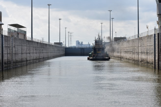
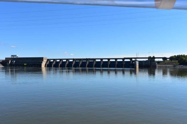
It was lifting just around 0945 so we started getting ready and cranked up the anchor at 1020. Surprisingly, it came up clean. I expected to bring up enough mud to make a hog happy. The other two boats came out just after us and in the Ohio River at 1105, Float Her joined our little group, but their catamaran is much faster and they went on ahead. We skirted the massive parking lot of anchored and tethered barges that clog the Ohio. I found good water to run in on the inside of the bend sticking to the left descending bank and running in between the barges anchored in the middle and the riverbank. It helped me stay out of the higher velocity water in the channel as we made our way upriver. We had to wait a few minutes at 1345 for the American Queen (tourist paddle wheeler) to clear the Olmsted Lock. The Olmsted Lock is still under construction (3 Billion of your tax dollars at work) so, at this time there is no lift, but they only let one boat at a time pass.


As the afternoon wore on, I noticed that we kept experiencing momentary loss of RPM’s. It was intermittent and I figured it had to be clogging of the secondary fuel filters. If we could make it to Paducah, I could change them there, but I really didn’t want to do something like that if we were going to be on anchor.


We continued on upstream and passed over the wickets at Lock 52 and docked just about a half hour after sunset on the fairly new Paducah municipal dock with help from John, the dock master. The dock is well lit and that helped. We had only been averaging about 6 mph coming up the Ohio even though I was pushing the RPM’s and we were glad to make the entire 45 miles from the anchorage. There is current at this dock that brings you to the dock from either side. We were on the outside and it pulled us in. Jane had cooked a curried dish while we were traveling and we ate dinner on the boat. We were hanging out after dinner when some other Looper boats came in and we all rushed out to help. There was a lot of excitement as some of the captains got to experience the effect of the eddy and hit another boat and the dock. There was no serious damage, but it was tense for a bit.
We stayed at Paducah for another day. They were having a massive BBQ festival. Ten years ago, I could have got my money’s worth on that. Jane did some shopping and I changed the secondary fuel filters, which was a learning curve since I had never done that before. I got that job done, tightened the lead for the tachometer, and replaced the air filter. I also refilled the water tanks and we were good to go. I showered and changed and we headed out to Paducah Beer Werks so we could watch the Gators dismantle Mississippi State.
Sunday, September 30, 2018:
It was sunny and 62 degrees in the morning. We got away from the dock without incident at 0810. We were headed to Green Turtle Bay on Barkley Lake. There are two ways to get there. The shorter route would be to go up the Tennessee River, through the Kentucky Lock and then cross through the canal that connects Kentucky Lake to Lake Barkley. We opted for the longer route going up the Ohio River to the mouth of the Cumberland River and then through the Barkley Lock. It’s longer (44 ½ miles), but the current on the Cumberland is reportedly less and there is a lot less barge traffic and typically very little wait for the Barkley Lock. The Ohio had lots of logs and debris to contend with, but the Cumberland was clean and scenic. We entered the Cumberland at 1018. At 1038 we passed Kentucky Chute where the water from the Ohio pours through and the brown muddy water of the Ohio gave way to the green water of the Cumberland. It was a little turbulent at the Chute, but quickly the Cumberland embraced us with a gentle current and pretty tree-lined bends. We only passed one down bound tow.


At 1500 we were waiting for the lock and tied in the shade of the high wall on the right.
Twenty minutes later the gates opened for us and we moved in and Jane lassoed a floating bollard. We had to wait a little bit for two more boats to join us, but soon we were being raised some 57 feet and by 1550 we were out of the lock. We arrived at the fuel dock of Green Turtle Bay for a pump-out and nestled into our slip at 1630. It was a skinny slip with floating finger piers on each side, and just wide enough for us and a couple of fenders. We bought ice when checking in and showered afterward. We met crews from Antonia, Felix, Phanthom, Float Her and Good Life at the pavilion for docktails before heading into the yacht club for dinner. It was a good day.